
TRAVERSING OF COMPASS SURVEYING
The surveying which involves a series of connected lines is known as Traversing. The sides of traverse are known as Traverse legs’.
In traversing, the lengths of the Traverse legs are measured by chain or tape. The directions of traverse legs are fixed by compass or Theodolite. If the traversing is done by using compass it is known as ‘Compass Traversing’.
Compass Traversing: In compass traversing, the fore and back bearings of the traverse legs are measured by prismatic or surveyor’s compass. The length of legs are measured with chain or tape. The observed bearings are checked and necessary corrections are applied for local attraction, if any, while plotting In case of closed traverse, closing error may occure while plotting. This closing error is adjusted graphically by using “Bowditch’s Rule
Compass Traverse may be of two types
1.CLOSED TRAVERSE AND
2.OPEN TRAVERSE
CLOSED TRAVERSE :
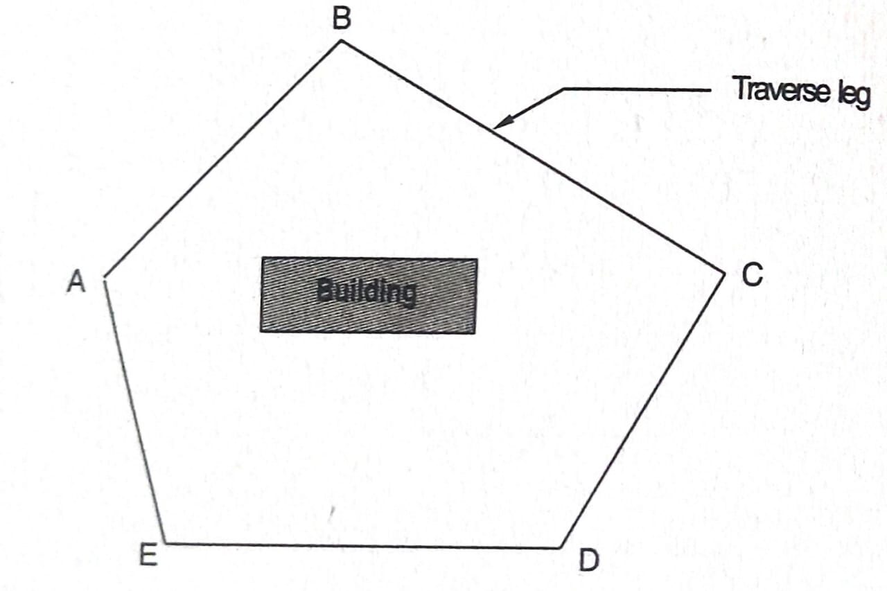
When a series of connected lines forms a closed circuit, i.e., the finishing point coincides with the starting point of the survey, it is called a ‘Closed Traverse the represents a closed traverse ABCDEA.
Closed traverse is suitable for the survey of boundaries of estates, ponds, forests etc.,
CHECK ON CLOSED TRAVERSE:
1. The sum of the measured interior angles should be equai to (2N-4) x 90°, where N is the number of sides of the traverse.
2. The sum of the exterior angles should be equal to (2N+4) x 90°.
3. The Algebric sum of the deflection angles should be equal to 360°. (Note: Taking Righthand deflection is positive and left hand deflection is negative).
4. The fore and back bearings of the line taken from the first and last stations should ‘differ by 180°. (ie., the FB of line EA observed from station ‘E’ and the B.B of line E A observed from station ‘A’ should differ by 180° Refer Fig. .
5. The linear measurements should also be measured by the stadia method. The measurements taken by chaining are tallied with them.
OPEN TRAVERSE:

When a series of connected lines extend along a general direction and does not return to the starting point, is known as Open Traverse.ABCDEF represents an open transverse Open Traverse is suitable for the survey of rivers, roads, coast lines etc.
Check on Open Traverse:
In case of open traverse, the measurements cannot be checked directly, by calculations. By taking additional field measurements the accuracy of the work can be checked by anyone of the following methods.
1. Taking Cut-off Lines: The open traverse can be checked by running the cut-off lines between certain intermediate stations. , AD and DG are the cut-off lines. The lengths and magnetic bearings of the cut-off lines AD and DG are measured accurately. While plotting the field work, the lengths and bearings of AD and DG are checked, to tally with the remaining data.
2. Taking an Auxiliary Station Point: Fig. 3.22 represents open traverse ABCDE. An auxiliary station point ‘P’ is selected on one side of it. The magnetic bearings of ‘P’ is observed from the traverse stations A, B, C, D and E. If the survey is carried accurately, while plotting field data, all the measured bearings of P, should meet at the auxiliary station point ‘P’
Compass Traversing: In compass traversing, the fore and back bearings of the traverse legs are measured by prismatic or surveyor’s compass. The length of legs are measured with chain or tape. The observed bearings are checked and necessary corrections are applied for local attraction, if any, while plotting In case of closed traverse, closing error may occure while plotting. This closing error is adjusted graphically by using “Bowditch’s Rule